This map shows the tribal allocations of the land of Canaan after the Israelites conquered the land under Joshua.
Handouts, maps, genealogies, timelines, etc.
This map shows the tribal allocations of the land of Canaan after the Israelites conquered the land under Joshua.
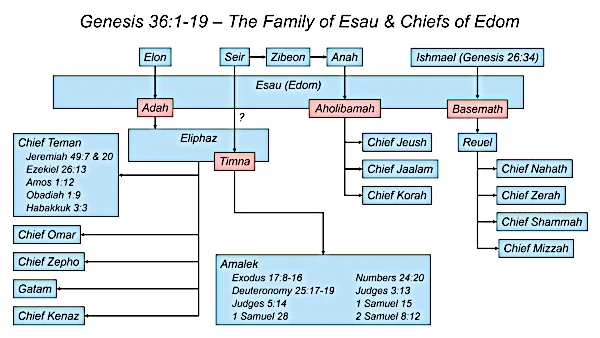
These family tree diagrams show the family relationships of Esau’s and Seir’s descendants listed in the Biblical text of Genesis 36 and 1 Chronicles 1:35-54. Men’s names are shown in blue. Women’s names are shown in pink.
This map shows the tribal allocations of the land of Canaan after the Israelites conquered the land under Joshua.
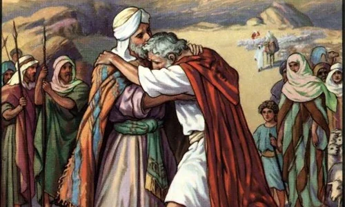
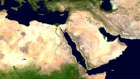
This map shows possible routes that Jacob and Esau may have taken to their meeting place east of the Jordan where they were reconciled after a 20-year estrangement. Also on the map is a potential location for Penuel where Jacob wrestled with God.
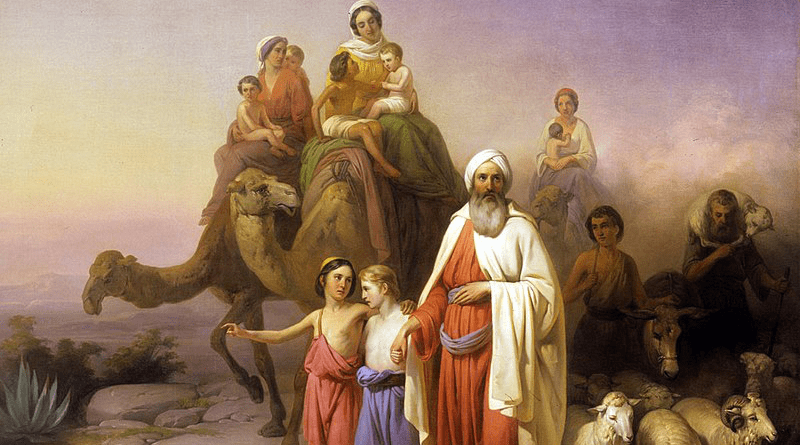
This map shows a possible route that Jacob may have followed on his return from Paddan-aram to Canaan along with a possible location for Galeed where Jacob and Laban made a non-aggression covenant.
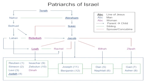
This diagram shows the family relationships of Jacob’s twelve sons who became the progenitors of the tribes of Israel. Their lineage is traced back to Abraham’s father Terah. The underlined names follow the line leading to Jesus.
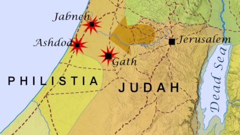
This map shows the territories of the Northern Kingdom of Israel, the Southern Kingdom of Judah, and the surrounding peoples during the reigns of Uzziah (a.k.a. Azariah) King of Judah and Jeroboam II King of Israel circa 780-740 BC. Significant events during the reigns of these two kings are also annotated.
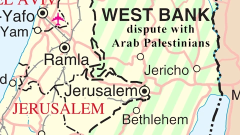
This map shows the boundaries between the nations of the Levant through the 20th century and early 21st century AD.
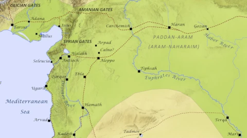
This map shows the northern reaches of the Tigris and Euphrates rivers and the so-called “fertile crescent” of Mesopotamia that lies between them. Also shown are Haran the ancestral home of Abram in the region of Paddan-Aram, and some of the other ancient cities of the northeast Mediterranean basin.