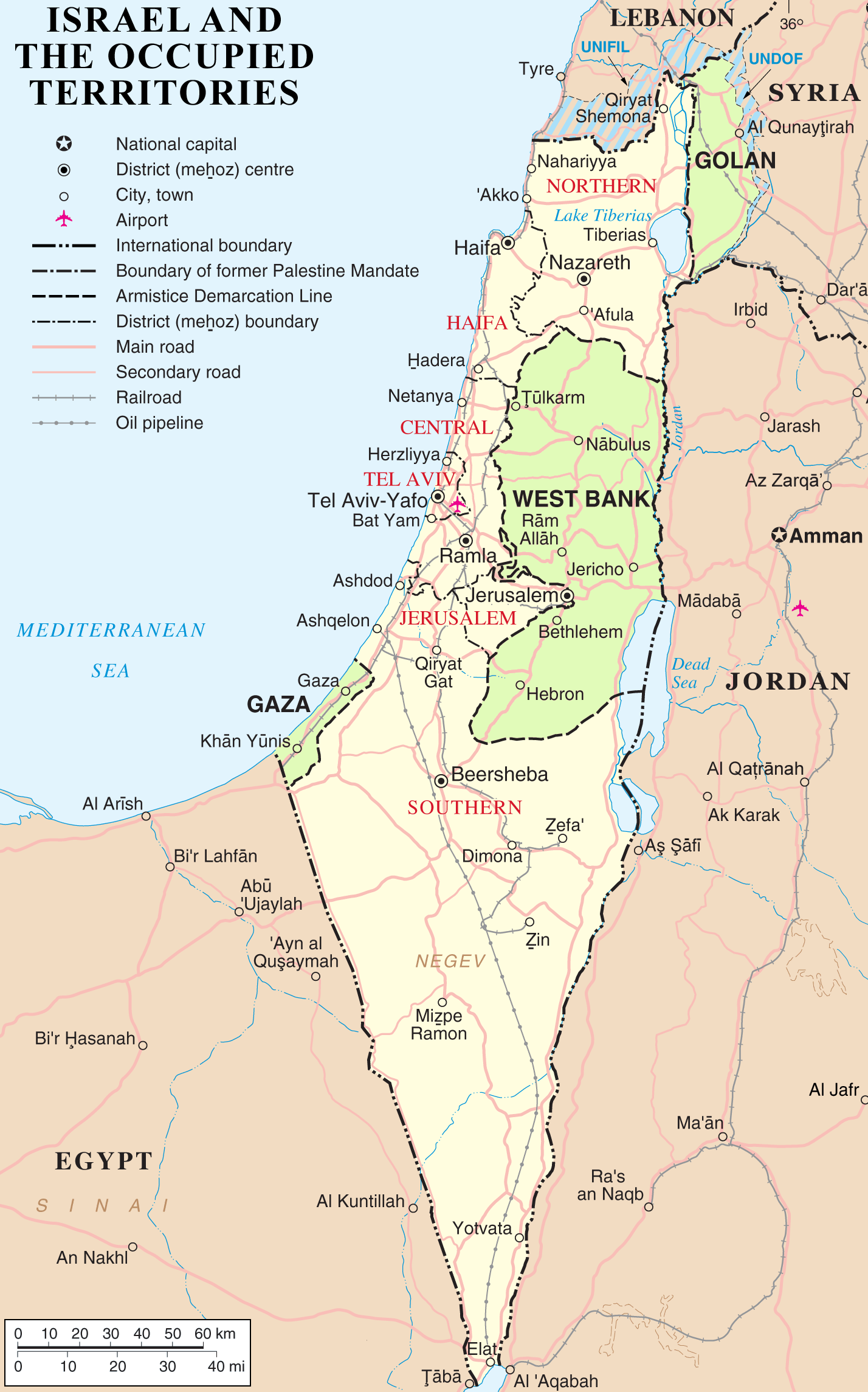
This map shows the boundaries of the modern state of Israel. The areas highlighted in green are the so-called “occupied territories” taken by Israel during the 1967 Six-day War – Gaza, The West Bank (Judea and Samaria), and The Golan Heights (Bashan). These areas are now governed by the Palestinian Authority except Gaza which is controlled by Hamas. The areas marked with blue stripes are the United Nations managed “demilitarized” zones between Israel, Syria, and Lebanon. Notice that on this map there is no national capital for the state of Israel. When the state of Israel was established, the provisional capital was Tel Aviv and Jerusalem was divided. When Israel took Jerusalem during the 1967 Six-day War, she declared Jerusalem as her capital. The UN does not recognize Jerusalem as Israel’s capital, and neither do many of the UN’s member nations.